Quick answer
Erg Chegaga is located approximately 360 kilometers southeast of Marrakech, a journey requiring 6 to 7 hours by vehicle including the final off-road segment. The route follows the N9 highway through the High Atlas to Ouarzazate, continues southeast via the Draa Valley to M'Hamid El Ghizlane, then covers 60 kilometers of roadless desert accessible only by 4x4 or camel trek.
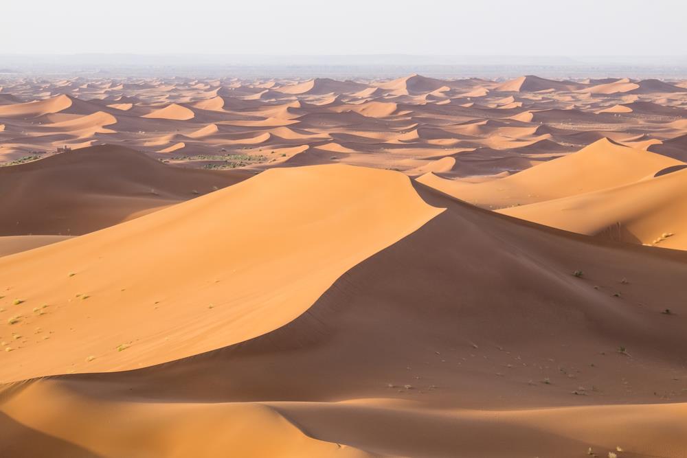
The Sahara begins not with a line on a map but with a gradual shift in landscape—palm groves thin, riverbeds widen into gravel plains, and the last paved road ends at M'Hamid El Ghizlane. From there, Erg Chegaga lies another 60 kilometers into wilderness that erases the concept of distance as drivers know it. The route from Marrakech follows the N9 south through Tizi n'Tichka pass, a 2,260-meter crossing of the High Atlas where switchbacks carve through cedar forests and Berber villages cling to slopes. Beyond Ouarzazate, the highway descends into the Draa Valley, a ribbon of date palms following an ancient caravan corridor. Zagora marks the threshold—beyond this town, infrastructure fades. M'Hamid, the final settlement, serves as the departure point for the roadless expanse separating travelers from the dunes. That final segment is not a road but a series of tracks across hamada plains and fossil beds, navigable only by experienced drivers or organized convoy. GPS coordinates replace signposts. Sand consistency varies by season—packed firm after winter rains, loose and treacherous under summer heat. The drive time expands or contracts based not on speed but on terrain conditions, driver skill, and vehicle capability. This is expedition travel, not highway transit. Elevation shifts shape the journey's character. Marrakech sits at 466 meters; Erg Chegaga's dune crests reach 300 meters above the surrounding desert floor, though the base elevation drops to near sea level. The cumulative distance from Marrakech becomes less relevant than the sequence of ecosystems crossed—mountain, valley, stone desert, sand sea. Each zone imposes its own logic on how travelers move, rest, and prepare. The question of how far the Sahara lies from Marrakech resolves into a starker calculation: how much desert can you handle, and what does that desert demand in return.
“The Sahara begins not with a line on a map but with a gradual shift in landscape—palm groves thin, riverbeds widen, and the last paved road ends at M'Hamid El Ghizlane.”
How Far Is The Sahara Desert From Marrakech to Erg Chegaga?
Erg Chegaga is located approximately 450-500km from Marrakech. The journey requires crossing the High Atlas Mountains via the Tizi n'Tichka pass before transitioning to off-road transit from M'Hamid El Ghizlane.
N9 road to Ouarzazate, then N12 to M'Hamid El Ghizlane
Private hire from Marrakech to M'Hamid El Ghizlane
Off-road transit from M'Hamid El Ghizlane to Erg Chegaga
What Is The Best Time of Year to Consider How Far Is The Sahara Desert From Marrakech?
The optimal window for visiting Erg Chegaga is during the shoulder seasons of spring and autumn, specifically March to May and September to November. These months provide moderate temperatures that make the necessary long-distance transit manageable.
Spring (March–May)
ModerateMild to warm; 20°C–28°C
Clear skies and comfortable temperatures facilitate daytime travel.
Autumn (Sept–Nov)
LowMild; 20°C–25°C
Ideal conditions for crossing the desert landscape before winter nights.
Winter (Dec–Feb)
LowCool to cold; 10°C–18°C
Days are short, though daytime travel remains pleasant.
Daily Arrivals
——
Adhere to the best arrival window of 06:00–18:00 to avoid mid-day heat and ensure safe navigation.
Verdict: The best time to visit is during the shoulder months of April or October, ensuring arrival between 06:00 and 18:00 to prioritize safe, daytime 4x4 transit.
Preparation Checklist for When Considering How Far Is The Sahara Desert From Marrakech
Reaching Erg Chegaga requires advance coordination and specialized equipment for the multi-hour off-road journey.
-
Book a guided 4x4 tour or expedition — Independent navigation is not recommended due to unmarked trails and remote terrain.
-
Confirm departure time with your operator — Most tours leave early morning to avoid midday heat and ensure daylight arrival.
-
Pack sun protection and layered clothing — Desert temperatures swing from scorching days to cold nights, especially in winter months.
-
Bring passport or national ID card — Checkpoint verification is standard when traveling through southern Morocco's desert provinces.
-
Charge devices and download offline maps — Mobile signal is absent for most of the route beyond M'Hamid El Ghizlane.
-
Carry sufficient water and snacks — No facilities exist between M'Hamid and the dunes; operators typically provide supplies but verify beforehand.
Daily Access Windows for How Far Is The Sahara Desert From Marrakech
Erg Chegaga is located in a remote desert region that remains accessible at all times, though travel should be planned carefully. Visitors should prioritize the recommended arrival window for safety.
| monday | 00:00–23:59 | |
|---|---|---|
| tuesday | 00:00–23:59 | |
| wednesday | 00:00–23:59 | |
| thursday | 00:00–23:59 | |
| friday | 00:00–23:59 | |
| saturday | 00:00–23:59 | |
| sunday | 00:00–23:59 |
Check availability
Common questions about how far is the sahara desert from marrakech
Everything you need to know about how far is the sahara desert from marrakech